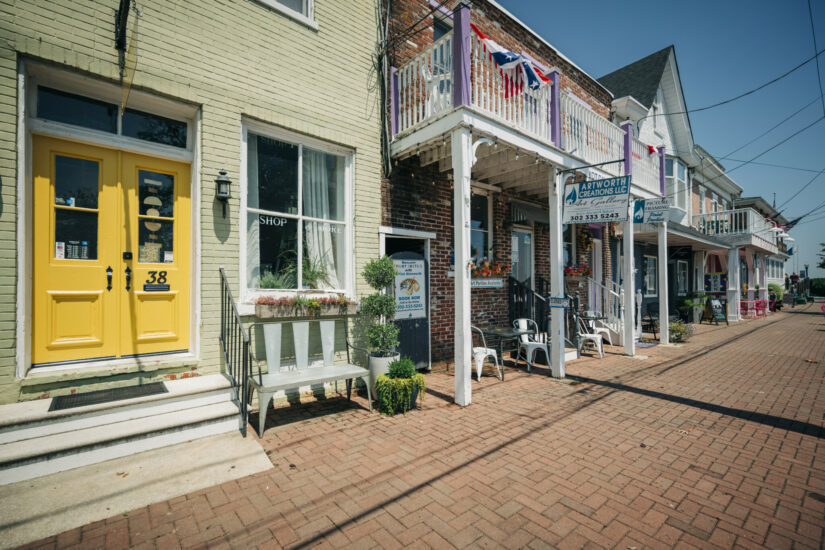
 Photo supplied by Main Street
Public-street views · documented local history
Take a Historic Walk Through Delaware City
Follow Clinton Street toward Battery Park, using the National Register inventory and the City's interpretive panels to read the town's buildings and canal setting.
Before you start
This is Main Street's suggested reading order along Clinton Street toward the waterfront, not the numbering of an official tour. Begin at 210 Clinton Street and continue toward the lower-numbered downtown addresses. Use the street-facing views and public waterfront areas; cross only where permitted and follow current signs.
Homes and other buildings may be private or in active use. Do not enter porches, gardens, yards or interiors without permission. Sidewalk conditions and closures can change; no distance, walking time or accessibility guarantee is given. Choose only the stops that work for your group.
Building dates and architectural descriptions below are attributed to the historical nomination inventory. They are not a present-day survey or a claim that each property is individually listed. The town was planned in 1826 and incorporated in 1851—learn more in City History.
City-hosted National Register district nominationSix stops toward the waterfront
210 Clinton Street
Begin on Clinton Street at the street-facing view of number 210.
The National Register inventory dates this frame dwelling to circa 1885 and records a side wing, hipped roof and porch with decorative cutwork brackets. It is a residential example from the later nineteenth century. Look from the public street; this guide does not offer house entry.
National Register inventory · page 25A. B. Davidson Building · 86 Clinton Street
Continue along Clinton Street toward its lower-numbered downtown addresses.
The nomination inventory identifies a circa-1850 frame commercial building at 86 Clinton Street. Its historical description records a gable roof and small eyebrow windows at the upper level. This stop offers a contrast with the residential buildings farther along the street: Clinton Street also developed as a place of trade.
National Register inventory · page 23J. Parson House · 68 Clinton Street
Continue toward the waterfront end of Clinton Street to number 68.
Recorded as the J. Parson House, this circa-1850 frame building appears in the same inventory with a gable roof and eyebrow windows. Read these details as the nomination's historical observations, not a current-condition survey. Private buildings are viewed from public routes only.
National Register inventory · page 23The Central Hotel · Canal and Clinton Streets
At the Canal and Clinton Street intersection, look at the historic hotel from the street.
The circa-1835 Central Hotel is recorded as a three-story brick building with a six-sided plan shaped by its triangular lot. The nomination describes Flemish-bond brickwork and fanlights above two doors. Its position beside the canal helps explain why accommodation and trade developed together here.
National Register inventory · page 4130 Clinton Street
Continue along Clinton Street to number 30, near the waterfront end of downtown.
The inventory dates the building at this address to 1828 and documents later alterations, including renovations in 1978–79. Historic does not mean unchanged: the record describes a building adapted over time. Today the address is home to Dolly Spanker's; consult the restaurant directly for visiting information.
National Register inventory · page 22The canal lock and Battery Park
Finish in the public waterfront area at the foot of Clinton Street. Follow posted signs and remain behind railings.
The City’s lock panel explains the surviving eastern lock of the original C&D Canal, its turning basin and diving bell. The canal opened in 1829; the eastern entrance later moved to Reedy Point as it became a sea-level waterway. Battery Park’s interpretive panels connect this engineering history with the town, forts and river.
City of Delaware City · The Lock panel
Notice the details, not just the dates
Compare frame and brick construction, roof shapes and upper-storey windows. The sequence includes homes, commercial buildings, a hotel and canal infrastructure—a reminder that a working canal town needed places to live, trade and host travelers. Avoid assuming every feature described in the historical record survives today.
Search the complete Historic Structures inventory →Add a meal, a shop or another chapter
The walk passes through downtown rather than an isolated historic site. Fit in local shops and art or a meal or bakery stop when open. Battery Park is the public-space pause at the end; find more waterside context in the waterfront guide.
For a fuller outing, Plan Your Visit and the day-trip guide connect downtown with the forts and trail. A ferry trip requires its own seasonal booking and return plan, not an extension of this street walk.
Keep exploring
Visit • Support • Connect
Something changed? Send Main Street a correction.