Battery Park Interpretive Exhibit · Installed 2011
About the Town
Seven interpretive panels along the Battery Park waterfront tell the story of this canal town — its birds, forts, wharves, workers, streets and waters. Read each panel’s story here, then open the City’s own document for the full text.
How these panels came to be
In November 2011 a Waterfront Interpretive Exhibit was installed in Battery Park, at the foot of Clinton Street. The City’s Historic District page describes the series as highlighting the area’s natural and historical features, with panels on the C&D Canal heronry, coastal defense forts, the waterfront, building the C&D Canal, the lock, local history and fishing.
The Battery Park Interpretive Sign Project was financed in part with federal funds from the National Park Service, Department of the Interior, through a grant from the Historic Preservation Fund. The City notes that the contents and opinions contained in the signage text do not necessarily reflect the views and policies of the Department of the Interior.
Where to stand
The panels line the Battery Park waterfront promenade beside the preserved canal lock, a short walk from the foot of Clinton Street. All seven are outdoors and free to visit at any time.
Plan your visitPanel artwork: City of Delaware City, Battery Park Interpretive Exhibit — production proof dated August 12, 2011. Rendered from the City’s own published panel documents.
01
Panel 1
C&D Heronry
- Pea Patch Island
- Birds
- Conservation
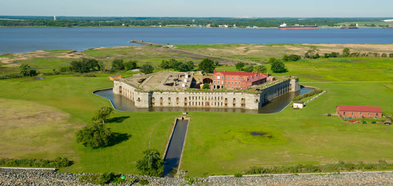
A half-mile off Battery Park, Pea Patch Island shelters one of America’s largest heron colonies.
While Fort Delaware occupies the southern end of the island, nine species of wading birds have settled on the marshy, forested northern tip. Called a heronry or rookery, the area provides a safe haven for thousands of migrating birds — 3,000 to 4,000 annually. The National Audubon Society and BirdLife International have recognized the heronry’s importance by designating it a “Continentally Important Bird Area.”
Delaware’s Department of Natural Resources and Environmental Control protects the birds by restricting access to their nesting area. Visitors walk a short distance from the fort to the edge of the preserve, where an observation tower provides a vantage point from which to see the large numbers of birds during the spring and summer months.
The panel also records the island’s size and its name: Pea Patch Island is a mile long and covers nearly 300 acres, and legend holds that it got its name when a ship loaded with peas foundered in the mud. The peas sprouted, took root and gradually spread.
02
Panel 2
Coastal Defense Forts
- Forts
- War of 1812
- Civil War
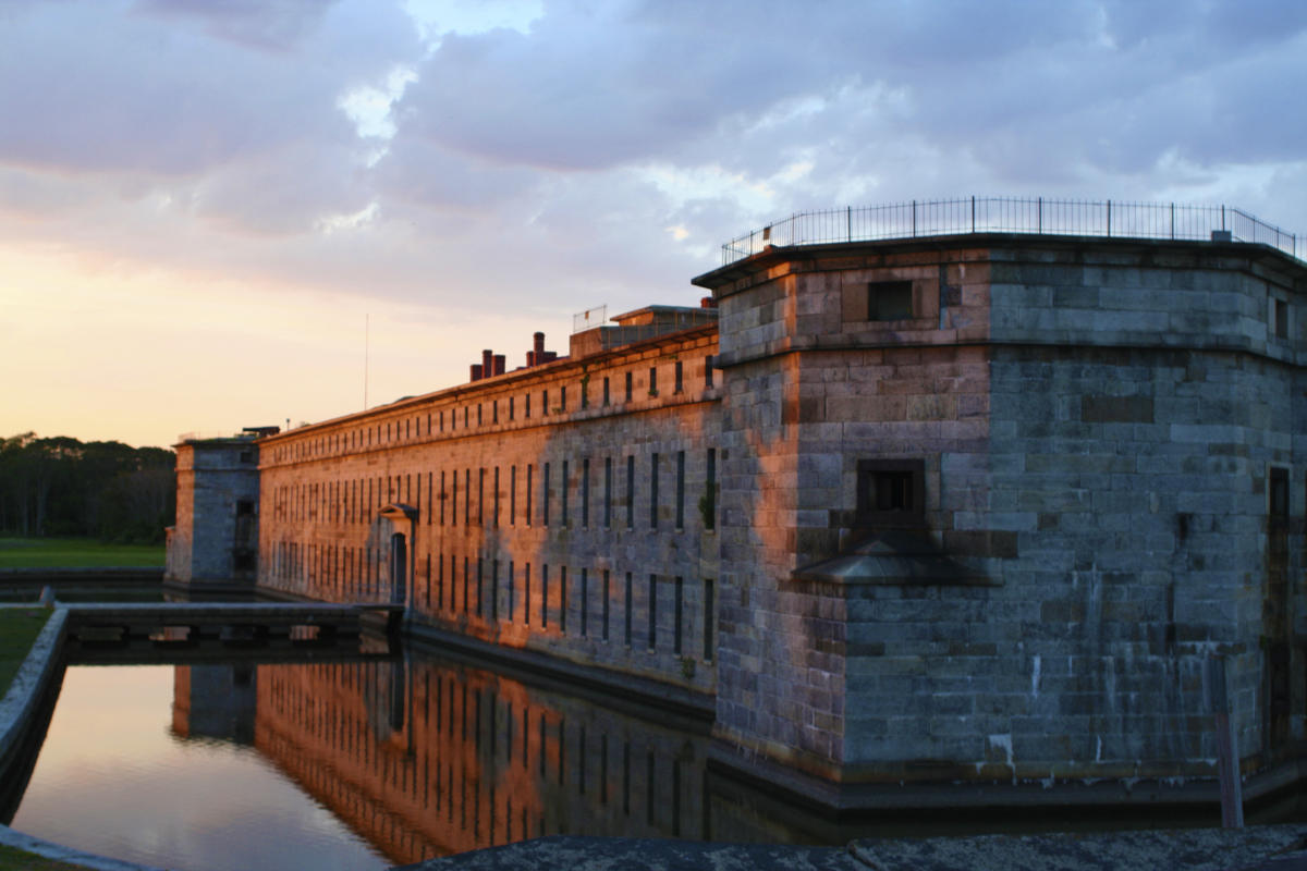
Three forts across the Delaware River were built to protect Wilmington and Philadelphia.
The British attack on Lewes, Delaware, during the War of 1812 demonstrated the need for forts to protect the Delaware River and the ports of Wilmington and Philadelphia. The War Department recognized Pea Patch Island’s strategic location and built two defensive structures there between 1813 and 1827; the second of them burned in 1831.
The present Fort Delaware, completed in 1859 just two years before the Civil War began, was a thoroughly modern defensive structure. Because the weak Confederate navy posed no real threat to the cities along the Delaware, and because the Union needed a facility to hold prisoners, the War Department converted the fort into a prisoner-of-war camp. Beginning in 1862, captured Confederate soldiers, political prisoners and federal convicts were imprisoned on the island.
Forts Mott, Delaware and DuPont form a three-fort defense system across the Delaware River. All three are now state parks — Fort Delaware and Fort DuPont under Delaware’s Division of Parks and Recreation, and Fort Mott under the New Jersey Division of Parks and Forestry.
03
Panel 3
Waterfront
- Commerce
- Steamboats
- Peach orchards
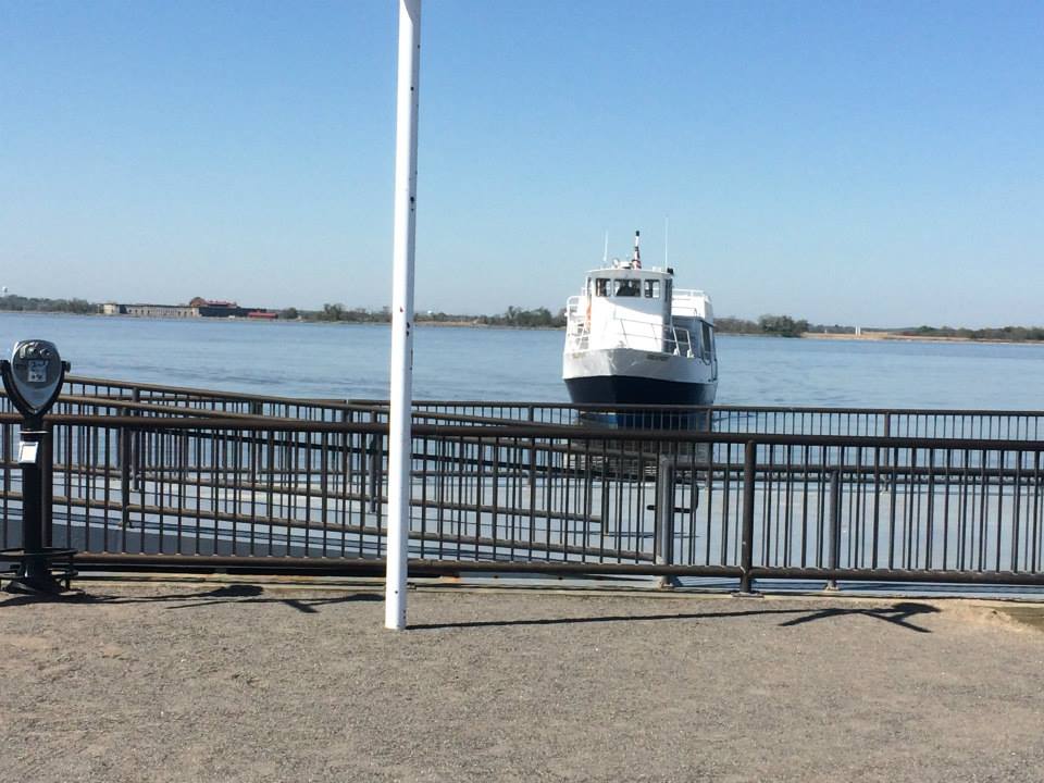
Today’s quiet waterfront promenade was once a busy commercial district of wharves, piers and sheds.
Around 1840, Philip (later “Major”) Reybold began growing peaches just north of Delaware City. By 1845 he had 110,000 peach trees and was shipping tens of thousands of baskets of peaches to Philadelphia, Baltimore and New York on his own steamboats, which docked at Major’s Wharf. In the late 1800s a peach blight struck, and by 1880 Reybold’s peaches were largely a thing of the past.
The waterfront included coal wharves, a steamboat dock, sheds and stores, and broad staging areas for local produce destined for markets in Philadelphia and Baltimore. Piers at both ends of the waterfront extended into the river some 250 feet to offer additional mooring places. Although the arrival of the railroad in 1873 challenged water transportation, commercial fishing and the shipment of wood and coal kept the port busy into the 20th century.
The river is still a vital shipping lane: less than two miles north of the city, modern docks serve vessels destined for the oil refinery that stands on land where peach orchards once flourished. The panel also tells of August 1885, when Captain Eugene Reybold brought the Major Reybold through a tornado that killed two people on shore and injured several others; the ship’s pilot, Emory Townsend, drowned. Repaired, the vessel carried passengers between Philadelphia and points south until about 1908.
04
Panel 4
Building C&D Canal
- Canal construction
- 1829
- Workers
- Built by
- Private investors operating as the Chesapeake and Delaware Canal Company, who raised the money by selling stock.
- Cost & time
- $2,250,000 and five years of digging by more than 2,600 workers — many Irish immigrant and African-American laborers — paid 75¢ a day.
- Opened
- October 17, 1829, with great celebrations. Horse- and mule-drawn barges predominated at first, until steam vessels took over the traffic.
- Today
- The U.S. government bought the canal from the private company in 1919, and by 1927 the Army Corps of Engineers had moved the river entrance to Reedy Point and dredged a sea-level channel.
From the panel
More than 2,600 workers dug the canal with picks and shovels for wages of 75¢ a day.
Although the idea of a waterway crossing the upper Delmarva peninsula was suggested in the 1600s, the canal did not become a reality until 1829. Over 2,600 workers, including many Irish immigrant and African-American laborers, dug the canal with picks and shovels for wages of 75¢ a day. When they were done, they had created a 14-mile long ditch that was ten feet deep and sixty feet wide, with four locks to carry ships over high and low waters, shortening the water route between Philadelphia and Baltimore by more than 300 miles.
The canal opened on October 17, 1829, with great celebrations. All manner of craft used it: initially horse- and mule-drawn barges predominated, but eventually steam-powered vessels made up the majority of canal traffic.
Private investors, operating as the Chesapeake and Delaware Canal Company, raised the money to build the canal by selling stock. The canal cost $2,250,000 and took five years to build.
The United States government purchased the canal from the private corporation in 1919. By 1927, the Army Corps of Engineers had relocated the Delaware River entrance of the canal to Reedy Point, two miles south of Delaware City, and eliminated the need for locks by dredging the waterway into a sea-level passage. The branch of the original canal that passes through Delaware City connects with the main C&D Canal two miles inland.
06
Panel 6
Lock
- Canal engineering
- National Register
- Diving bell
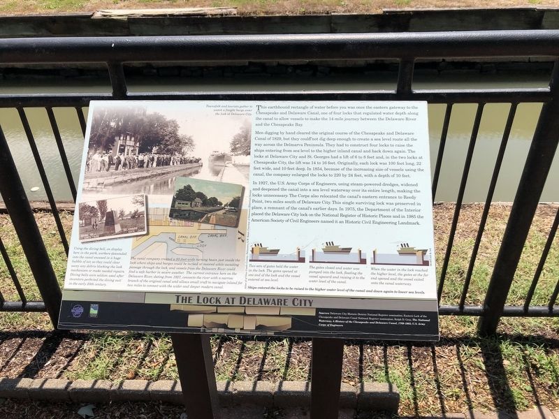
The earthbound rectangle of water at Battery Park was once the eastern gateway to the C&D Canal.
This was one of four locks that regulated water depth along the canal so vessels could make the 14-mile journey between the Delaware River and the Chesapeake Bay. Men digging by hand cleared the original course of 1829, but they could not dig deep enough to create a sea-level route all the way across the Delmarva Peninsula, so four locks raised ships from sea level to the higher inland canal and back down again. The locks at Delaware City and St. Georges had a lift of 6 to 8 feet; in the two locks at Chesapeake City the lift was 14 to 16 feet.
Originally each lock was 100 feet long, 22 feet wide and 10 feet deep. In 1854, because of the increasing size of vessels using the canal, the company enlarged the locks to 220 by 24 feet, with a depth of 10 feet. In 1927 the U.S. Army Corps of Engineers, using steam-powered dredges, widened and deepened the canal into a sea-level waterway over its entire length, making the locks unnecessary, and moved the canal’s eastern entrance to Reedy Point. This single surviving lock was preserved in place. In 1975 the Department of the Interior placed the Delaware City lock on the National Register of Historic Places, and in 1985 the American Society of Civil Engineers named it an Historic Civil Engineering Landmark.
The canal company created a 90-foot-wide turning basin just inside the lock where ships and barges could be turned or moored while awaiting passage. The diving bell now on display in the park — made in Philadelphia in 1839 for the Chesapeake and Delaware Canal Company — let workers descend into the canal encased in a huge bubble of air so they could clear obstructions and make underwater repairs to the lock gates.
07
Panel 7
History
- Founding
- Newbold family
- Streets
- 1801
- The Newbold brothers of New Jersey acquired 1,600 acres on the Delaware River; John Newbold’s grain wharf gave the site the name Newbold’s Landing.
- 1825–27
- News that the canal’s eastern terminus would lie south of the landing prompted Newbold’s sons to lay out a new town. The first lots sold in 1826, and by 1827 the town had ten houses.
- 1887
- A fire destroyed buildings along Clinton Street and led to the “Volunteer Fire Company,” renamed the Delaware City Hose Company two years later.
- After 1927
- When the canal entrance shifted to Reedy Point, the city’s remaining economic benefit from the canal disappeared.
From the panel
Delaware City’s story begins in 1801, when the Newbold brothers acquired 1,600 acres on the Delaware River.
Barzilla, Clayton and John Newbold of New Jersey bought the land, and John Newbold built a wharf that became a center for trading and shipping grain, giving the site the name Newbold’s Landing. In 1824 came the news that a canal connecting the Delaware River and Chesapeake Bay would have its eastern terminus just south of Newbold’s Landing. That prompted John Newbold’s sons, Daniel and William, to lay out a new town they named Delaware City. In 1826 they completed and sold the first lots, and by 1827 the town had ten houses and a population sufficient to justify a July 4th celebration that included a festive outdoor dinner at a table that filled Delaware Street between Clinton and Washington streets.
The urban grid and the width of Washington, Clinton and Adams streets demonstrated the Newbold brothers’ expectation that Delaware City would soon rival Philadelphia. Clinton Street — with its trolley tracks shown about 1909 — honors DeWitt Clinton, governor of New York and chief proponent of New York’s Erie Canal.
Delaware City was both a base for canal operations, conducting vessels through the lock and collecting tolls, and a way station for travelers needing hotels, stables, food and other services. The economic boom associated with shipping goods across the peninsula on the canal waned with competition from railroads, and after 1927, when the Delaware River entrance to the canal shifted to Reedy Point, any remaining economic benefits to the city from the canal disappeared. Although Delaware City’s growth did not live up to its founders’ financial expectations, the town grew into a community of charming tree-lined streets and inviting neighborhoods.
In 1887 a fire destroyed a number of buildings along Clinton Street, prompting local citizens to form the “Volunteer Fire Company,” renamed two years later the “Delaware City Hose Company.” The company’s original equipment was hand-operated and hauled to fires by the volunteers on foot.
08
Panel 8
Fishing
- Fishing
- Hunting
- Trapping
- Sturgeon
- By the 1880s the Delaware River was the country’s largest sturgeon fishing ground. Its roe was salted, packed in 135-pound kegs and shipped to Europe as caviar.
- Shad
- Prized for their flavor, shad were harvested from the river in the millions of pounds during the 1890s and early 1900s.
- Wildfowl
- Market gunners packed ducks in barrels with ice and shipped them by steamboat to Philadelphia and Baltimore until protective legislation curtailed the harvest in 1918.
- Today
- The State of Delaware protects much of the marshland around Delaware City as state parks and wildlife areas.
From the panel
The rivers and marshes around Delaware City provided ideal habitat for fishes, waterfowl and muskrats.
In the 1800s, local residents thought this wildlife would always be available and abundant. Harvesting fish and birds in excessive numbers put populations at risk, and serious pollution in the Delaware River reinforced the downward trend. The annual springtime spawning runs of sturgeon, shad and herring became increasingly precarious.
By the 1880s the Delaware River was the country’s largest sturgeon fishing ground. Fishermen harvested sturgeon roe, salted it, packed it in 135-pound kegs and shipped it to Europe as caviar. As the price rose from $12 per keg in 1885 to over $100 by 1900, harvests increased until the sturgeon were nearly wiped out. In spring the shad swam from the Atlantic Ocean to spawn upstream in the fresh waters of the Delaware River; prized for their excellent flavor, they were harvested from the river in the millions of pounds during the 1890s and early 1900s.
Local “market gunners” harvested ducks, packed them in barrels with ice and shipped them via steamboat to Philadelphia, Baltimore and beyond. In the early 1900s the range and power of hunting guns increased, allowing ever larger harvests of wildfowl until protective legislation curtailed them; the passage of the Migratory Bird Treaty Act of 1918 largely put an end to the hunting that had harvested hundreds of thousands of birds annually. Winter was the time for trapping muskrats — a large rodent native to North America, prized mainly for its pelt but also valued for its meat and for its musk glands, which produce a distinctive scent used to make certain perfumes.
Today the State of Delaware protects much of the marshland around Delaware City as state parks and wildlife areas.
Keep exploring
City History
The founding of Delaware City, the canal chronology and the stories of both forts, with archive sources.
City History →Life on the Water
Marina access, dock fishing guidance and updates on the campground planned for 2027.
On the Water →Historic Structures
The district’s homes, walking-tour stories and the complete National Register inventory.
Historic Structures →