Delaware Public Archives · Delaware State Parks
Delaware City & the Forts
A canal town, an island fortress and a riverfront military post—three connected chapters of Delaware history.
The founding of Delaware City
A town planned beside the canal
Delaware Public Archives traces the town’s beginnings to the Newbold family, who owned land along the Delaware River and drew up a town plot in 1826. Canal construction and shipbuilding helped a community take shape around this waterfront location.
The Archives’ Old Public School historical marker identifies 1826 as the founding year. Municipal incorporation came later, in 1851. These dates describe different milestones: the planned settlement and the creation of its local government.
Delaware Public Archives: Delaware City town historyArchives: Old Public School historical markerThe original canal · Opened in 1829
The Lock at Delaware City
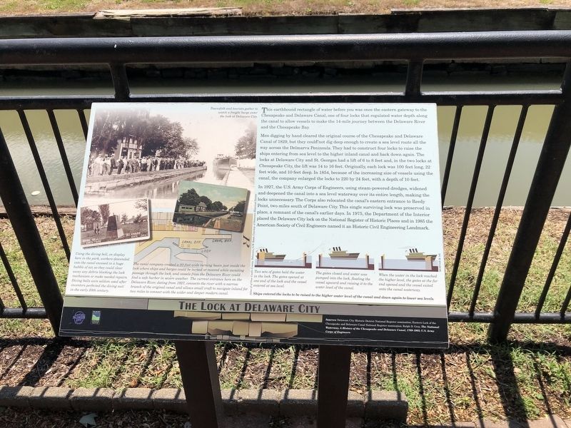
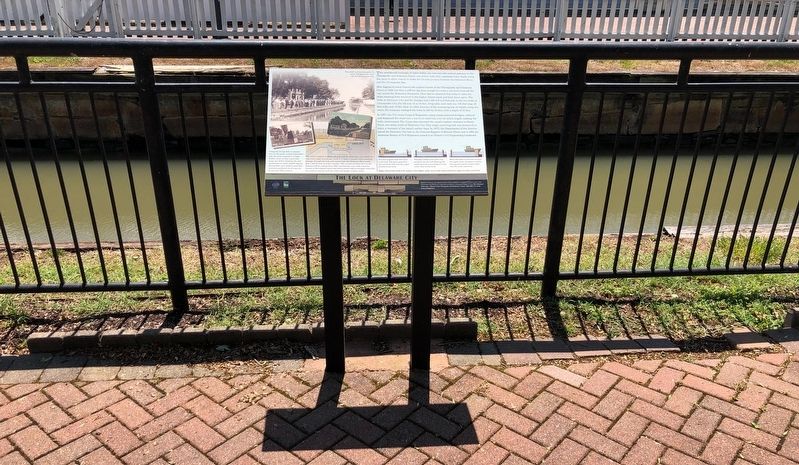
Delaware City was the eastern gateway to the original Chesapeake and Delaware Canal. Four locks raised and lowered vessels along the 14-mile waterway between the Delaware River and Chesapeake Bay.
From lock canal to sea-level waterway
According to the marker, the locks were enlarged in 1854 to accommodate bigger vessels. In 1927, the U.S. Army Corps of Engineers widened and deepened the canal into a sea-level route and moved its eastern entrance to Reedy Point. The Delaware City lock survives as a reminder of the earlier canal.
A landmark you can visit
Find the interpretive marker near 55 Clinton Street. The marker records National Register recognition in 1975 and Historic Civil Engineering Landmark recognition in 1985.
Read the marker & view its photographsBattery Park Panel 6 · The LockBattery Park Panel 4 · Building the C&D CanalFrom canal construction to community
1824
Canal construction begins
After discussion dating to the eighteenth century, construction began on the Chesapeake and Delaware Canal.
1826
The Newbold town plot
The Newbold family laid out a town along the Delaware River, before the canal was completed.
1829
The canal is completed
The canal bisected the earlier plotted area. Shipbuilding was already active and a community was forming.
1851
Municipal incorporation
A state act formed the Commissioners of the Town of Delaware City and required a recorded town plot defining boundaries and streets north of the canal.
1883
A growing town’s public school
A new public school met the needs of a growing population, another sign of the community’s development around the canal.
Chronology summarized from Delaware Public Archives’ town history and Old Public School marker.
Polktown · Free Black community
Voices Long Forgotten
Polktown is a historic free Black community in the Delaware City area, where the African Union Church was based. Its historical marker describes one of Delaware’s earliest remaining free Black settlements, continuously occupied for nearly two centuries, extending on both sides of the historic branch canal with a church, school and residences.
The marker connects Polktown’s early fortunes to the canal and traces African American land ownership through purchases by Reverend Shadrach Boyer and his two sons, followed by Perry Reynolds and Betsy Green in 1853. Today’s neighborhood remains a reminder of the original community.
In 1835, five Black trustees established the church and cemetery near the Chesapeake and Delaware Canal. The cemetery preserves the graves of five United States Colored Troops veterans who served the Union during the Civil War.
The Friends, established in 1996, led restoration and public-history work at this burial ground, which is owned by Mount Salem UAME Church. Their film Voices Long Forgotten tells the story of Polktown, the cemetery and Private James H. Elbert.
Pea Patch Island
Fort Delaware
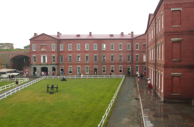
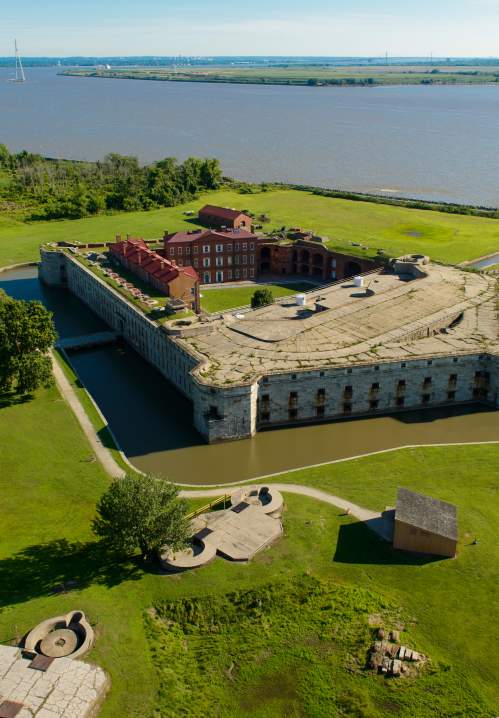
Fort Delaware was built in the mid-nineteenth century as a federal coastal-defense fort to protect Wilmington and Philadelphia. Its island location placed it in the Delaware River’s defensive network.
During the Civil War, the fort held more than 33,000 Confederate and political prisoners. The Archives marker records that about 2,400 Confederate prisoners died; many were buried at Finn’s Point National Cemetery in New Jersey. This history is an important part of understanding the fort beyond its walls and military demonstrations.
After service during both World Wars, the fort returned to Delaware and was preserved in 1951 as one of the state’s first parks. Today, visitors reach the island by seasonal ferry and explore its history through park programs.
Archives: Fort Delaware historical markerFort Delaware today: visits & programsBattery Park Panel 2 · Coastal Defense Forts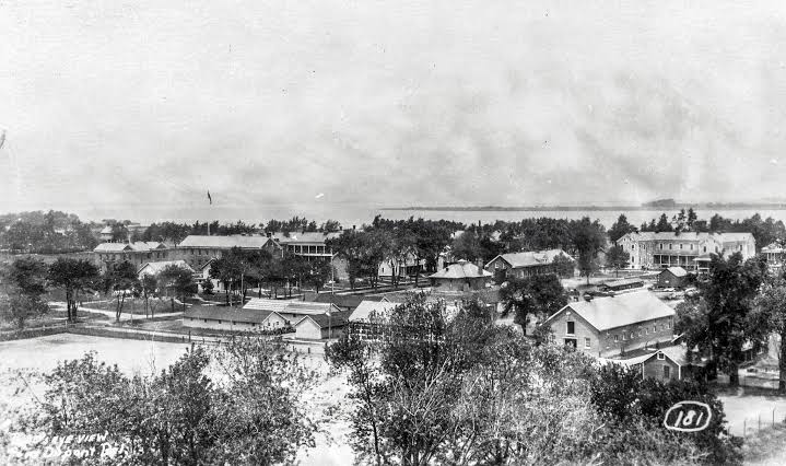
On the Delaware City riverfront
Fort DuPont
Fort DuPont was a separate mainland military installation named for Civil War naval officer Samuel Francis du Pont. Like Fort Delaware, it helped defend the Delaware River’s port cities, including Wilmington and Philadelphia, against enemy ships.
Delaware State Parks’ walking-tour materials describe its military-base period as 1899–1945. In the early twentieth century, steel-barreled, breech-loading guns stood in concrete emplacements as part of the coastal-defense system. The installation served during World War I and World War II.
The preserved parade grounds, historic buildings and outdoor gun batteries reveal the scale of the former post. Today’s park combines recreation with preservation. Explore marked public trails and respect closures rather than assuming every historic structure is open.
Delaware State Parks: Fort DuPontOfficial Fort DuPont walking-tour historyBattery Park Panel 2 · Coastal Defense FortsA new chapter for the Fort DuPont Theater
Explore the restoration of the historic 1933 theater and ways to support its future as a place for arts, culture and community.
Theater restoration & ways to help →Delaware Public Archives collections
Look back through the Archives
Clinton Street, circa 1950
The Archives’ Delaware City history page includes a historic Clinton Street view, identified as RG 9015-028-000. Explore the original photograph and the town’s story in the state collection.
View the Clinton Street photograph at the ArchivesThe canal’s working past
The George R. Lynam Jr. collection documents Chesapeake and Delaware Canal locks, bridges, construction and canal traffic, particularly around St. Georges. These images provide regional canal context; they are not all views of Delaware City.
Explore the canal photograph collectionBoats and buildings along the basin
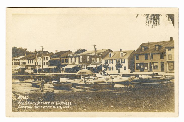
Two early Delaware City postcards in the state collection show boats moored beside the basin and the homes and businesses along its banks. The Archives dates both to approximately 1907–1930, rather than a single confirmed year.
Historic structures downtown
Explore the district’s homes, architectural stories and the original National Register inventory on their dedicated page.
Historic structures & National Register inventory →Battery Park Interpretive Exhibit · Installed 2011
Seven panels tell the town’s story
In November 2011 a Waterfront Interpretive Exhibit was installed in Battery Park at the foot of Clinton Street. The City’s Historic District page notes that the Battery Park Interpretive Sign Project was financed in part with federal funds from the National Park Service, Department of the Interior, through a grant from the Historic Preservation Fund, and that the signage text does not necessarily reflect the views and policies of the Department of the Interior.
Panel 1
C&D Heronry
A half-mile off Battery Park, Pea Patch Island shelters one of America’s largest heron colonies.
Read the panel ↗Panel 2
Coastal Defense Forts
Three forts across the Delaware River were built to protect Wilmington and Philadelphia.
Read the panel ↗Panel 3
Waterfront
Today’s quiet waterfront promenade was once a busy commercial district of wharves, piers and sheds.
Read the panel ↗Panel 4
Building C&D Canal
More than 2,600 workers dug the canal with picks and shovels for wages of 75¢ a day.
Read the panel ↗Panel 6
Lock
The earthbound rectangle of water at Battery Park was once the eastern gateway to the C&D Canal.
Read the panel ↗Panel 7
History
Delaware City’s story begins in 1801, when the Newbold brothers acquired 1,600 acres on the Delaware River.
Read the panel ↗Panel 8
Fishing
The rivers and marshes around Delaware City provided ideal habitat for fishes, waterfowl and muskrats.
Read the panel ↗
Panel artwork: City of Delaware City, Battery Park Interpretive Exhibit — production proof dated August 12, 2011.
Forts & living history
History comes to life
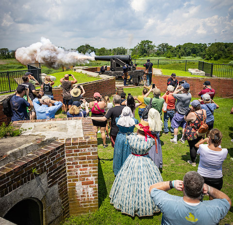
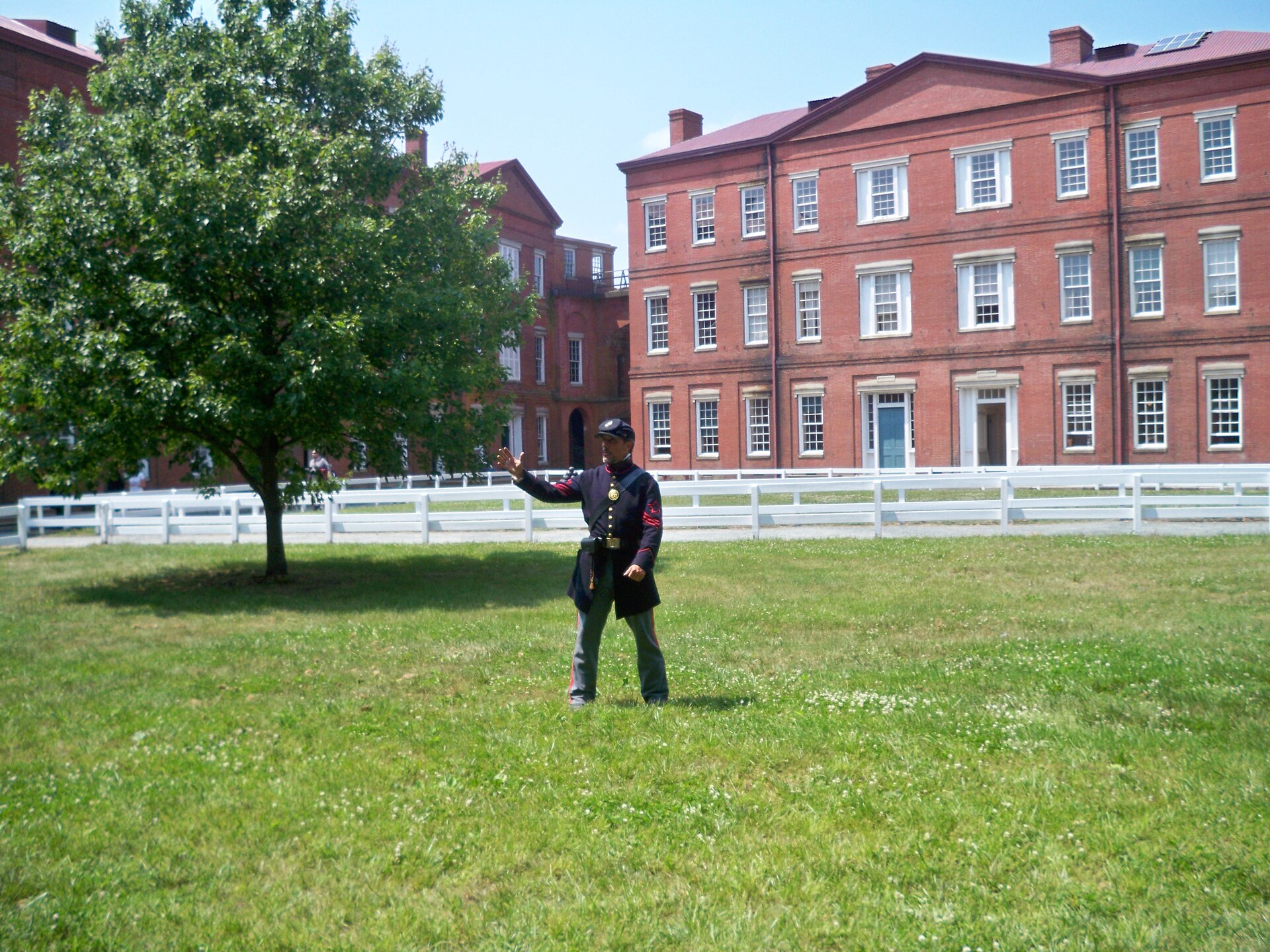
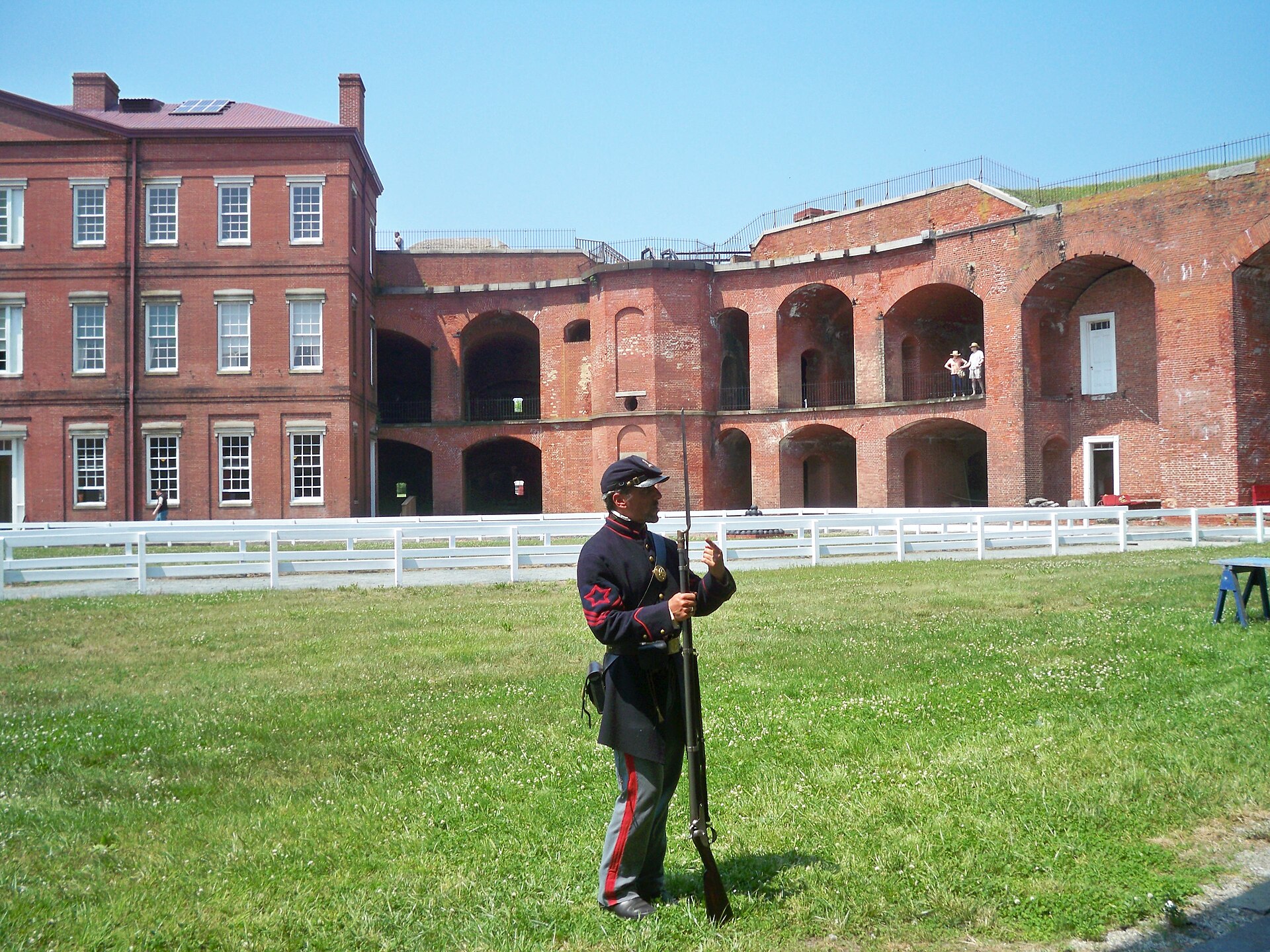
Living history at Fort Delaware
Photo supplied by Main Street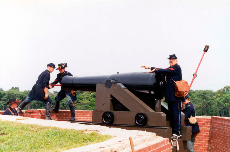
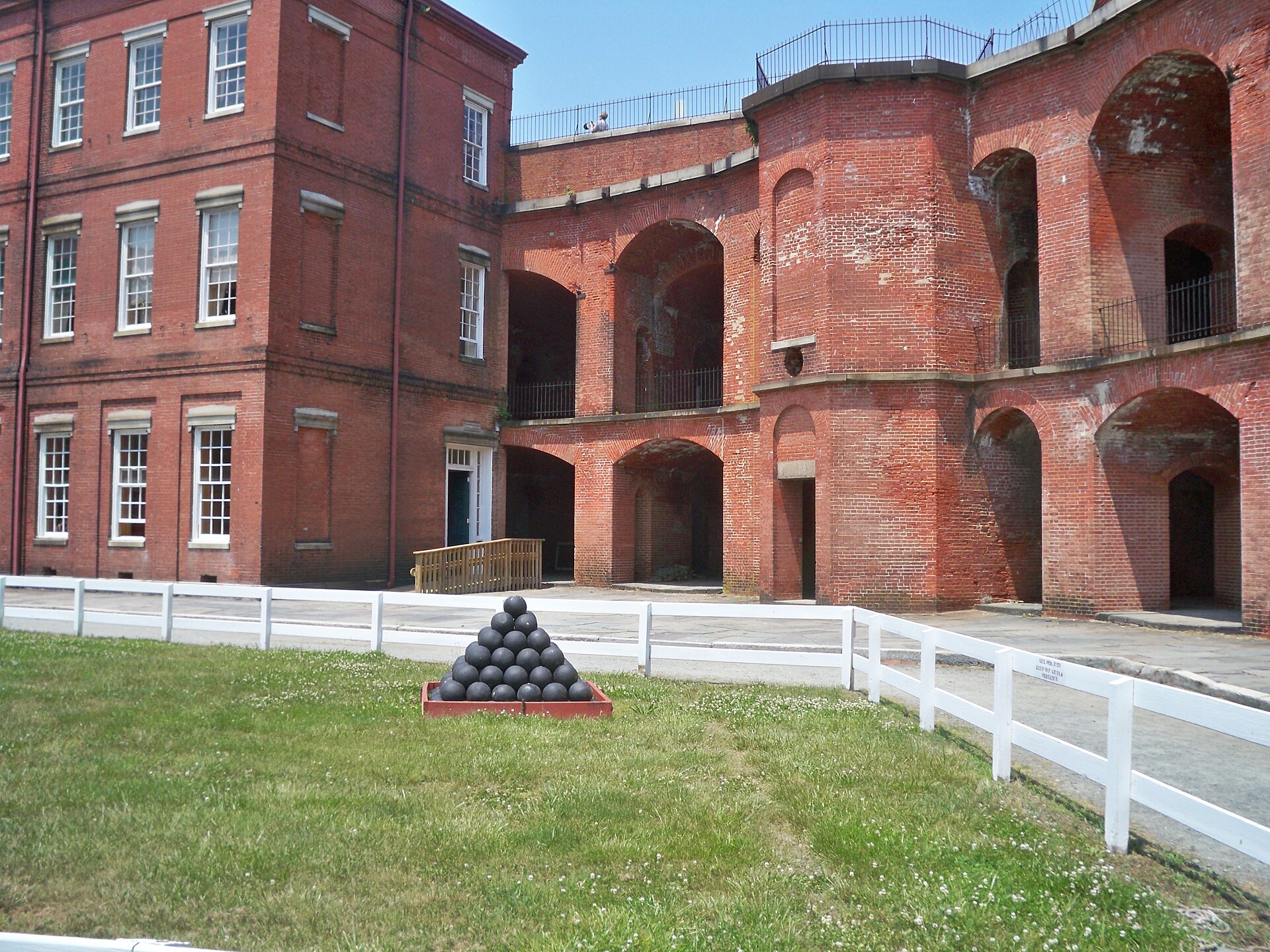
The work behind a cannon demonstration
Photo supplied by Main Street